BOSTON HARBORWALK ︎︎︎
. Bicycling from UMass, a journey unfolds,
. Harborwalk's tales, in whispers, it holds.
. To Carson Beach, where waves gently play,
. Castle Island stands, a historic array.
. Past Long Wharf's tales and ships that sway,
. Charles River's breeze guides the way.
. From campus to river, a seamless glide,
. Harborwalk's charm, in each turn, abides.
Despite having a long stretch through downtown Boston along Massachusetts Avenue and through the Seaport District, this loop follows much of the coastline of the Boston harbor, from the University of Massachusetts Campus all the way up to the North End and back along the Cambridge side of the Charles River.
The path provides plenty of opportunities to stop in a multitude of waterfront parks that offer views to sea. Returning the city from the coastline, the route takes a detour along the Boston Harborwalk. Both the Harborwalk, Carson Beach, and Castle Island can get busy with foot traffic during the summer so watch out for pedestrians.
ridewithgps route...
︎︎︎ N Ō ø / >
xx ++ ~ --- ^ ⌄
︎︎︎ = Type: Loop
N = Transit: None
Ō= Cost: $0.00
ø = Duration: Half day
/ = Access: Near
> = Length: 16.7 mi
N = Transit: None
Ō= Cost: $0.00
ø = Duration: Half day
/ = Access: Near
> = Length: 16.7 mi
xx = Road: 52 %
++ = Path: 48 %
~ = Dirt: 2 %
--- = Paved: 98 %
^ = Elevation: +246 ft
⌄ = Elevation: -246 ft
++ = Path: 48 %
~ = Dirt: 2 %
--- = Paved: 98 %
^ = Elevation: +246 ft
⌄ = Elevation: -246 ft
* Riding from the Head Island Causeway onto Castle Island.
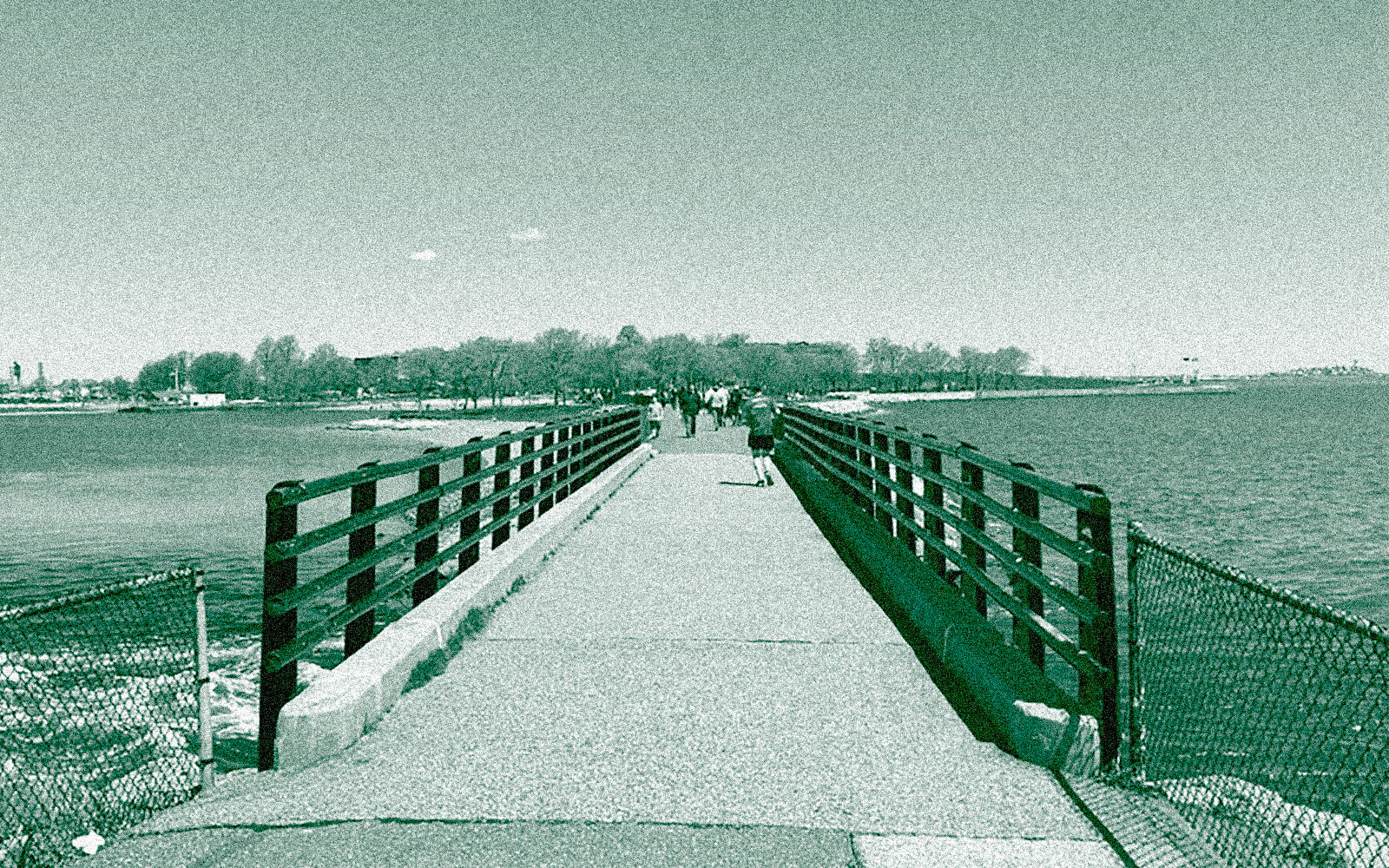
*Looking back at the route from University of Massachusetts Boston over the water in the distance from the Head Island Causeway.

* The walking and cycle path wraps around the edge of Fort Independence with views out into Boston Bay.

* On the path from Carson Beach towards Castle Island.

* The Boston Harborwalk in Seaport gives a nice perspective of the city’s financial district.

* Passing by the JFK memorial library on the University of Massachussets Boston campus.
