ASHUWILLTICOK RAIL TRAIL ︎︎︎
. Upon the Ashuwillticook's gentle trail,
. In Berkshires' embrace, the wind sets sail.
. Bicycling through nature's verdant grace,
. Keatsian dreams in every pedal's pace.
. A symphony of leaves, a whispered song,
. Majestic mountains where dreams belong.
. Handlebars grasp the essence of delight,
. In prolonged verse, the journey takes flight.
The Ashuwillticook Rail Trail is a moderate ride out in the Berkshires of Western Massachusetts, nearby the border of New York. Its so far out in Western MA that you’re going to need to ask a friend who has a car and bike rack to take you out there since there is no public transportation that will reliably get you here.
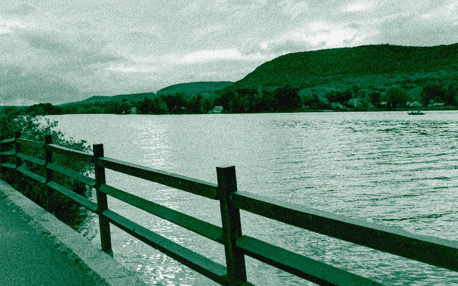
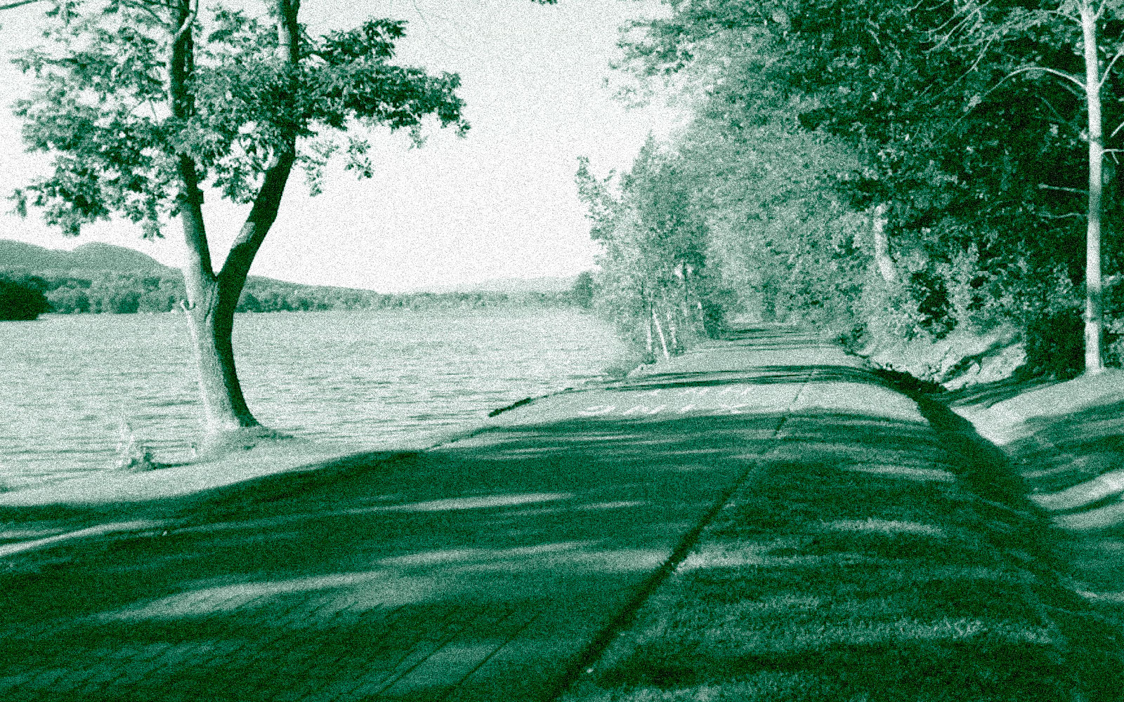
The trailhead is nestled in a valley between mount Greylock and Savoy Mountain just a few miles south of Mass MoCA and Smith College in North Adams. The biking and walking path follows the Hoosic River down to the Cheshire Reservoir, passing along many waterfalls and hiking trailheads.
ridewithgps route...
. In Berkshires' embrace, the wind sets sail.
. Bicycling through nature's verdant grace,
. Keatsian dreams in every pedal's pace.
. A symphony of leaves, a whispered song,
. Majestic mountains where dreams belong.
. Handlebars grasp the essence of delight,
. In prolonged verse, the journey takes flight.
The Ashuwillticook Rail Trail is a moderate ride out in the Berkshires of Western Massachusetts, nearby the border of New York. Its so far out in Western MA that you’re going to need to ask a friend who has a car and bike rack to take you out there since there is no public transportation that will reliably get you here.
The trailhead is nestled in a valley between mount Greylock and Savoy Mountain just a few miles south of Mass MoCA and Smith College in North Adams. The biking and walking path follows the Hoosic River down to the Cheshire Reservoir, passing along many waterfalls and hiking trailheads.
ridewithgps route...
︎︎︎ Ć $$$ ó /// >
x +++ ~ --- ^^ ⌄⌄
︎︎︎ = Type: Return
Ć = Transit: Car
$$$ = Cost: $60.00
ó = Duration: Full Day
/// = Access: Far
> = Length: 27.3 mi
Ć = Transit: Car
$$$ = Cost: $60.00
ó = Duration: Full Day
/// = Access: Far
> = Length: 27.3 mi
x = Road: 1 %
+++ = Path: 99 %
~ = Dirt: 0 %
--- = Paved: 100 %
^^ = Elevation: +545 ft
⌄⌄ = Elevation: -545 ft
+++ = Path: 99 %
~ = Dirt: 0 %
--- = Paved: 100 %
^^ = Elevation: +545 ft
⌄⌄ = Elevation: -545 ft
* A view out onto the Cheshire Reservoir on a cloudy day.
* Intimmate biking path passing through the the dappled shadows cast by the canopy of trees next to the Hoosic river.

*The edge where path meets water.
* Information stands for curious cyclists, runners and dog walkers.
